 vesseltracker.com
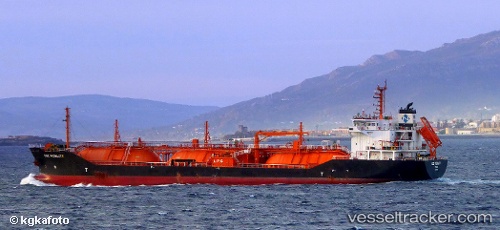
 GAS LISBON
Current Status
Where is the vessel?
GAS LISBON is currently in Near Baniyas, based on AIS data received about 1h ago.
Latest AIS update:
Current position: 35.21458° N, 35.91210° E (Near Baniyas)
Average speed (last 7 days): Loading…
Average speed (last 30 days): Loading…
Vessel profile: GAS LISBON is a Lpg Tanker with dimensions m x m.
This page combines live AIS, route history, probable destination signals, nearby traffic, and port activity for practical vessel monitoring.
The current position of vessel GAS LISBON is 35.21458 lat / 35.91210 lng. Updated: 2026-05-17 23:40:32 UTCNearest reference points:
- Near Al Ladhiqiyah
- Near Tartous
- Near Al Latakia
Currently sailing under the flag of Liberia ![]()
Details:
Live Vessel GAS LISBON Analytics (details, animations, etc.)
Recent AIS points (UTC):
2026-05-17 18:58:32 UTC · 35.21440, 35.91221 · SOG 0.1 kn · COG 214°2026-05-17 20:13:32 UTC · 35.21453, 35.91213 · SOG 0 kn · COG 216°
2026-05-17 22:49:32 UTC · 35.21463, 35.91191 · SOG 0.1 kn · COG 208°
2026-05-17 23:40:32 UTC · 35.21458, 35.91210 · SOG 0 kn · COG 214°