 vesseltracker.com
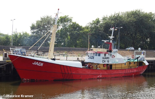
Jadi
Current StatusWhere is the vessel?
Jadi is currently in Near Rio De Janeiro, based on AIS data received about 1h ago.
Latest AIS update:
Current position: 22.89857° S, 43.17538° W (Near Rio De Janeiro)
Average speed (last 7 days): Loading…
Average speed (last 30 days): Loading…
Vessel profile: Jadi is a Offshore Support Vessel with dimensions 7m x 36m.
This page combines live AIS, route history, probable destination signals, nearby traffic, and port activity for practical vessel monitoring.
The current position of vessel Jadi is -22.89857 lat / -43.17538 lng. Updated: 2026-05-17 07:57:14 UTCNearest reference points:
- Near Rio De Janeiro
- Near NITEROI
- Near Santos Dumont Apt/Rio de Janeiro
Details:
Live Vessel Jadi Analytics (details, animations, etc.)
Recent AIS points (UTC):
2026-05-17 04:15:54 UTC · -22.89856, -43.17537 · SOG 0.2 kn · COG 324°2026-05-17 06:27:15 UTC · -22.89858, -43.17538 · SOG 0.1 kn · COG 325°
2026-05-17 07:51:13 UTC · -22.89858, -43.17537 · SOG 0.3 kn · COG 325°
2026-05-17 07:57:14 UTC · -22.89857, -43.17538 · SOG 0.1 kn · COG 326°