 vesseltracker.com
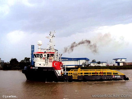
 MACAE
MACAE
Current Status
Where is the vessel?
MACAE is currently in 104 nm N of Quiterianópolis, based on AIS data received about 10d ago.
Latest AIS update:
Current position: 7.54811° N, 40.94645° W (104 nm N of Quiterianópolis)
Average speed (last 7 days): Loading…
Average speed (last 30 days): Loading…
Vessel profile: MACAE is a Pollution Control Vessel with dimensions 14m x 63m.
This page combines live AIS, route history, probable destination signals, nearby traffic, and port activity for practical vessel monitoring.
The current position of vessel MACAE is 7.54811 lat / -40.94645 lng. Updated: 2026-05-07 12:37:17 UTCCurrently sailing under the flag of Brazil ![]()
MACAE built in 1983 year
Deadweight:
1499 tDetails:
Live Vessel MACAE Analytics (details, animations, etc.)
Recent AIS points (UTC):
2026-05-07 12:37:17 UTC · 7.54811, -40.94645 · SOG 1.8 kn · COG 71°2026-05-07 12:37:17 UTC · 7.54811, -40.94645 · SOG 1.8 kn · COG 71°
2026-05-07 12:37:17 UTC · 7.54811, -40.94645 · SOG 1.8 kn · COG 71°
2026-05-07 12:37:17 UTC · 7.54811, -40.94645 · SOG 1.8 kn · COG 71°