 vesseltracker.com
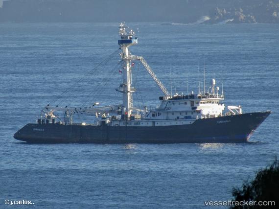
Almirante 1
Current StatusWhere is the vessel?
Almirante 1 is currently in 239 nm SW of Puerto Villamil, Isla Isabela, based on AIS data received about 9d ago.
Latest AIS update:
Current position: 3.04691° S, 94.38942° W (239 nm SW of Puerto Villamil, Isla Isabela)
Average speed (last 7 days): Loading…
Average speed (last 30 days): Loading…
Vessel profile: Almirante 1 is a Fishing Vessel with dimensions 13m x 78m.
This page combines live AIS, route history, probable destination signals, nearby traffic, and port activity for practical vessel monitoring.
The current position of vessel Almirante 1 is -3.04691 lat / -94.38942 lng. Updated: 2026-05-07 19:15:48 UTCNearest reference points:
- Open sea, approx. 401 nm off the nearest listed port
- Open sea, approx. 412 nm off the nearest listed port
- Open sea, approx. 409 nm off the nearest listed port
Details:
Live Vessel Almirante 1 Analytics (details, animations, etc.)
Recent AIS points (UTC):
2026-05-07 19:15:48 UTC · -3.04691, -94.38942 · SOG 10.2 kn · COG 276°2026-05-07 19:15:48 UTC · -3.04691, -94.38942 · SOG 10.2 kn · COG 276°
2026-05-07 19:15:48 UTC · -3.04691, -94.38942 · SOG 10.2 kn · COG 276°
2026-05-07 19:15:48 UTC · -3.04691, -94.38942 · SOG 10.2 kn · COG 276°