 vesseltracker.com
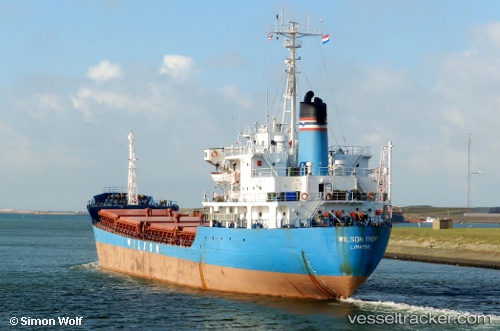
 MAYA S
Current Status
Where is the vessel?
MAYA S is currently in Near Carmen de la Legua, based on AIS data received about 1d ago.
Latest AIS update:
Current position: 12.03217° S, 77.05568° W (Near Carmen de la Legua)
Average speed (last 7 days): Loading…
Average speed (last 30 days): Loading…
Vessel profile: MAYA S is a General Cargo with dimensions m x m.
This page combines live AIS, route history, probable destination signals, nearby traffic, and port activity for practical vessel monitoring.
The current position of vessel MAYA S is -12.03217 lat / -77.05568 lng. Updated: 2026-05-16 01:27:05 UTCNearest reference points:
- Near Callao
- 43 nm SW of Barranca
- 125 nm SW of Supe Bay
Currently sailing under the flag of Tanzania ![]()
Details:
Live Vessel MAYA S Analytics (details, animations, etc.)
Recent AIS points (UTC):
2026-05-16 01:27:05 UTC · -12.03217, -77.05568 · SOG -0.1 kn · COG 316°2026-05-16 01:27:05 UTC · -12.03217, -77.05568 · SOG -0.1 kn · COG 316°
2026-05-16 01:27:05 UTC · -12.03217, -77.05568 · SOG -0.1 kn · COG 316°
2026-05-16 01:27:05 UTC · -12.03217, -77.05568 · SOG -0.1 kn · COG 316°