 vesseltracker.com
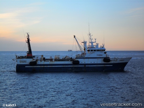
Granit
Current StatusWhere is the vessel?
Granit is currently in 40 nm SW of Grossriedenthal, based on AIS data received less than 1h ago.
Latest AIS update:
Current position: 48.00925° N, 154.61452° E (40 nm SW of Grossriedenthal)
Average speed (last 7 days): Loading…
Average speed (last 30 days): Loading…
Vessel profile: Granit is a Fishing Vessel with dimensions 13m x 64m.
This page combines live AIS, route history, probable destination signals, nearby traffic, and port activity for practical vessel monitoring.
The current position of vessel Granit is 48.00925 lat / 154.61452 lng. Updated: 2026-05-18 04:21:08 UTCDetails:
Live Vessel Granit Analytics (details, animations, etc.)
Recent AIS points (UTC):
2026-05-17 23:56:09 UTC · 47.95849, 154.61678 · SOG 10.9 kn · COG 24°2026-05-18 02:00:28 UTC · 47.99161, 154.64687 · SOG 4.3 kn · COG 228°
2026-05-18 03:49:50 UTC · 47.95562, 154.52196 · SOG 2.9 kn · COG 20°
2026-05-18 04:21:08 UTC · 48.00925, 154.61452 · SOG 10.4 kn · COG 66°