 vesseltracker.com
 LOS AMIGOS
Current Status
Where is the vessel?
LOS AMIGOS is currently in Near Kaukab Abu El-Hija, based on AIS data received about 1h ago.
Latest AIS update:
Current position: 32.70677° N, 15.02033° E (Near Kaukab Abu El-Hija)
Average speed (last 7 days): Loading…
Average speed (last 30 days): Loading…
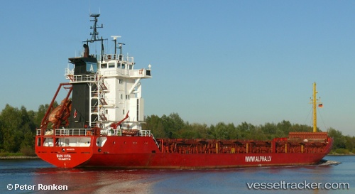
Vessel profile: LOS AMIGOS is a General Cargo with dimensions m x m.
This page combines live AIS, route history, probable destination signals, nearby traffic, and port activity for practical vessel monitoring.
The current position of vessel LOS AMIGOS is 32.70677 lat / 15.02033 lng. Updated: 2026-05-15 13:30:01 UTCNearest reference points:
- Near MISURATA
- 22 nm NW of Tarabulus
- 37 nm E of Didon
Currently sailing under the flag of Saint Kitts and Nevis ![]()
Details:
Live Vessel LOS AMIGOS Analytics (details, animations, etc.)
Recent AIS points (UTC):
2026-05-15 10:15:59 UTC · 32.42459, 15.57808 · SOG 10.5 kn · COG 321°2026-05-15 11:45:52 UTC · 32.59228, 15.34602 · SOG 10.3 kn · COG 295°
2026-05-15 13:07:59 UTC · 32.68416, 15.08994 · SOG 10.2 kn · COG 290°
2026-05-15 13:30:01 UTC · 32.70677, 15.02033 · SOG 10.3 kn · COG 290°