 vesseltracker.com
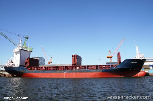
 ST. MARIA
Current Status
Where is the vessel?
ST. MARIA is currently in Near RUMELI FENERI, based on AIS data received about 1h ago.
Latest AIS update:
Current position: 41.26496° N, 29.05854° E (Near RUMELI FENERI)
Average speed (last 7 days): Loading…
Average speed (last 30 days): Loading…
Vessel profile: ST. MARIA is a General Cargo Ship with dimensions 100m x 16m.
This page combines live AIS, route history, probable destination signals, nearby traffic, and port activity for practical vessel monitoring.
The current position of vessel ST. MARIA is 41.26496 lat / 29.05854 lng. Updated: 2026-05-17 19:32:12 UTCNearest reference points:
- Near RUMELI FENERI
- Near Istinye/Istambul
- Near Arnavutköy/Istambul
Currently sailing under the flag of St.Kitts and Nevis ![]()
ST. MARIA built in 1994 year
Deadweight:
4766 tDetails:
Live Vessel ST. MARIA Analytics (details, animations, etc.)
Recent AIS points (UTC):
2026-05-17 16:53:11 UTC · 41.26462, 29.05828 · SOG 0 kn · COG 94°2026-05-17 17:56:13 UTC · 41.26467, 29.05838 · SOG 0 kn · COG 113°
2026-05-17 19:08:12 UTC · 41.26497, 29.05848 · SOG 0 kn · COG 136°
2026-05-17 19:32:12 UTC · 41.26496, 29.05854 · SOG 0 kn · COG 140°