 vesseltracker.com
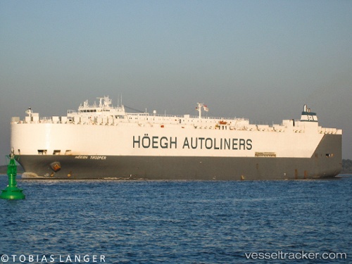
Hoegh Trooper
Current StatusWhere is the vessel?
Hoegh Trooper is currently in Near Chongming, based on AIS data received about 1h ago.
Latest AIS update:
Current position: 31.59080° N, 121.45618° E (Near Chongming)
Average speed (last 7 days): Loading…
Average speed (last 30 days): Loading…
Vessel profile: Hoegh Trooper is a Vehicles Carrier with dimensions 32m x 200m.
This page combines live AIS, route history, probable destination signals, nearby traffic, and port activity for practical vessel monitoring.
The current position of vessel Hoegh Trooper is 31.59080 lat / 121.45618 lng. Updated: 2026-05-18 07:45:38 UTCNearest reference points:
- Near Chongming
- Near Baoshan Pt
- Near Taicang
Details:
Live Vessel Hoegh Trooper Analytics (details, animations, etc.)
Recent AIS points (UTC):
2026-05-18 04:24:38 UTC · 31.59082, 121.45619 · SOG 0 kn · COG 117°2026-05-18 05:51:38 UTC · 31.59083, 121.45620 · SOG 0 kn · COG 117°
2026-05-18 07:24:38 UTC · 31.59080, 121.45618 · SOG 0 kn · COG 117°
2026-05-18 07:45:38 UTC · 31.59080, 121.45618 · SOG 0 kn · COG 117°