 vesseltracker.com
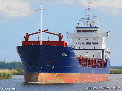
 KAILI
KAILI
Current Status
Where is the vessel?
KAILI is currently in Near ZAANDAM, based on AIS data received less than 1h ago.
Latest AIS update:
Current position: 52.39704° N, 4.86142° E (Near ZAANDAM)
Average speed (last 7 days): Loading…
Average speed (last 30 days): Loading…
Vessel profile: KAILI is a General Cargo with dimensions m x m.
This page combines live AIS, route history, probable destination signals, nearby traffic, and port activity for practical vessel monitoring.
The current position of vessel KAILI is 52.39704 lat / 4.86142 lng. Updated: 2026-05-17 23:23:44 UTCNearest reference points:
- Near ZAANDAM
- Near Amsterdam
- Near Zaanstad
Currently sailing under the flag of Antigua and Barbuda ![]()
Details:
Live Vessel KAILI Analytics (details, animations, etc.)
Recent AIS points (UTC):
2026-05-17 20:08:04 UTC · 52.39704, 4.86147 · SOG 0 kn · COG 216°2026-05-17 21:41:42 UTC · 52.39704, 4.86145 · SOG 0 kn · COG 216°
2026-05-17 22:41:05 UTC · 52.39704, 4.86147 · SOG 0 kn · COG 216°
2026-05-17 23:23:44 UTC · 52.39704, 4.86142 · SOG 0 kn · COG 216°