 vesseltracker.com
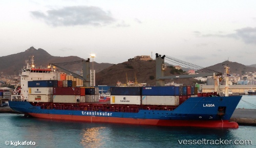
 LAGOA
LAGOA
Current Status
Where is the vessel?
LAGOA is currently in 198 nm N of Ilha do Sal, based on AIS data received about 1h ago.
Latest AIS update:
Current position: 20.04167° N, 22.62667° W (198 nm N of Ilha do Sal)
Average speed (last 7 days): Loading…
Average speed (last 30 days): Loading…
Vessel profile: LAGOA is a General Cargo with dimensions m x m.
This page combines live AIS, route history, probable destination signals, nearby traffic, and port activity for practical vessel monitoring.
The current position of vessel LAGOA is 20.04167 lat / -22.62667 lng. Updated: 2026-05-17 14:21:31 UTCNearest reference points:
- 176 nm NE of Ilha do Sal
- 129 nm N of Mindelo
- 61 nm NW of Ilha do Sal
Currently sailing under the flag of Portugal ![]()
Details:
Live Vessel LAGOA Analytics (details, animations, etc.)
Recent AIS points (UTC):
2026-05-17 10:01:20 UTC · 20.89916, -21.95197 · SOG 15.4 kn · COG 219°2026-05-17 11:39:32 UTC · 20.57366, -22.21468 · SOG 14.8 kn · COG 219°
2026-05-17 13:57:55 UTC · 20.12145, -22.56788 · SOG 14.6 kn · COG 217°
2026-05-17 14:21:31 UTC · 20.04167, -22.62667 · SOG 14 kn · COG -1°