 vesseltracker.com
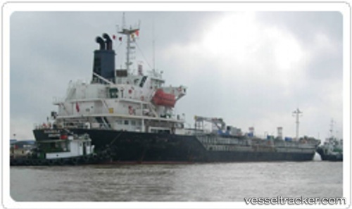
 ROBA
ROBA
Current Status
Where is the vessel?
ROBA is currently in 38 nm NW of SELAATA, based on AIS data received less than 1h ago.
Latest AIS update:
Current position: 34.55317° N, 34.95639° E (38 nm NW of SELAATA)
Average speed (last 7 days): Loading…
Average speed (last 30 days): Loading…
Vessel profile: ROBA is a Oil/Chemical Tanker with dimensions m x m.
This page combines live AIS, route history, probable destination signals, nearby traffic, and port activity for practical vessel monitoring.
The current position of vessel ROBA is 34.55317 lat / 34.95639 lng. Updated: 2026-05-17 13:45:23 UTCNearest reference points:
- Near Tripoli
- Near Zouk
- Near DBAIYEH
Currently sailing under the flag of Palau ![]()
Details:
Live Vessel ROBA Analytics (details, animations, etc.)
Recent AIS points (UTC):
2026-05-17 09:26:16 UTC · 34.92489, 35.64643 · SOG 10.1 kn · COG 269°2026-05-17 10:13:45 UTC · 34.86937, 35.50846 · SOG 9.6 kn · COG 235°
2026-05-17 12:16:27 UTC · 34.68326, 35.18526 · SOG 9.3 kn · COG 236°
2026-05-17 13:45:23 UTC · 34.55317, 34.95639 · SOG 9.5 kn · COG 235°