 vesseltracker.com
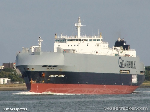
Jaeger Arrow
Current StatusWhere is the vessel?
Jaeger Arrow is currently in Near La Relance, based on AIS data received about 115d ago.
Latest AIS update:
Current position: 50.16051° N, 66.45794° W (Near La Relance)
Average speed (last 7 days): Loading…
Average speed (last 30 days): Loading…
Vessel profile: Jaeger Arrow is a General Cargo Ship with dimensions 25m x 172m.
This page combines live AIS, route history, probable destination signals, nearby traffic, and port activity for practical vessel monitoring.
The current position of vessel Jaeger Arrow is 50.16051 lat / -66.45794 lng. Updated: 2026-01-21 14:37:23 UTCNearest reference points:
- 22 nm N of Sainte-Anne-des-Monts
- 15 nm NW of Saint-Anaclet
Details:
Live Vessel Jaeger Arrow Analytics (details, animations, etc.)
Recent AIS points (UTC):
2026-01-21 14:37:23 UTC · 50.16051, -66.45794 · SOG 0 kn · COG 42°