 vesseltracker.com
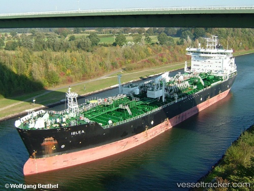
 IBLEA
IBLEA
Current Status
Where is the vessel?
IBLEA is currently in 43 nm E of Cidade de Angra dos Reis FPSO, based on AIS data received less than 1h ago.
Latest AIS update:
Current position: 25.46896° S, 42.03551° W (43 nm E of Cidade de Angra dos Reis FPSO)
Average speed (last 7 days): Loading…
Average speed (last 30 days): Loading…
Vessel profile: IBLEA is a Oil/Chemical Tanker with dimensions m x m.
This page combines live AIS, route history, probable destination signals, nearby traffic, and port activity for practical vessel monitoring.
The current position of vessel IBLEA is -25.46896 lat / -42.03551 lng. Updated: 2026-05-18 06:12:51 UTCNearest reference points:
- 34 nm S of Cidade de Angra dos Reis FPSO
- 69 nm NE of Cidade de Angra dos Reis FPSO
- 49 nm S of SEPETIBA
Currently sailing under the flag of Portugal ![]()
Details:
Live Vessel IBLEA Analytics (details, animations, etc.)
Recent AIS points (UTC):
2026-05-18 01:57:23 UTC · -26.02643, -42.77225 · SOG 11.9 kn · COG 43°2026-05-18 03:36:11 UTC · -25.81310, -42.49046 · SOG 12.1 kn · COG 50°
2026-05-18 04:58:03 UTC · -25.63453, -42.25851 · SOG 12.2 kn · COG 50°
2026-05-18 06:12:51 UTC · -25.46896, -42.03551 · SOG 12.8 kn · COG 49°