 vesseltracker.com
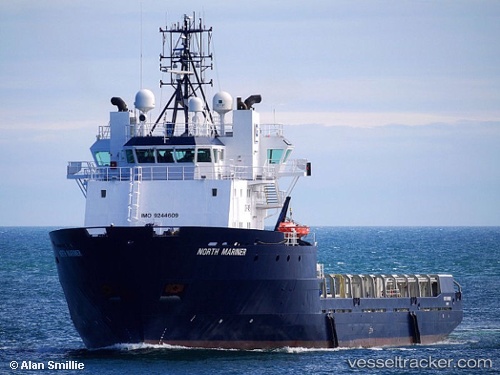
 SAR MARINER
Current Status
Where is the vessel?
SAR MARINER is currently in Near Eforie Sud, based on AIS data received about 1h ago.
Latest AIS update:
Current position: 43.96879° N, 28.74361° E (Near Eforie Sud)
Average speed (last 7 days): Loading…
Average speed (last 30 days): Loading…
Vessel profile: SAR MARINER is a Offshore Supply Ship with dimensions m x m.
This page combines live AIS, route history, probable destination signals, nearby traffic, and port activity for practical vessel monitoring.
The current position of vessel SAR MARINER is 43.96879 lat / 28.74361 lng. Updated: 2026-05-17 13:53:19 UTCNearest reference points:
- Near Constanta
- 20 nm E of Eforie Sud
- Near MIDIA
Currently sailing under the flag of Norway ![]()
Details:
Live Vessel SAR MARINER Analytics (details, animations, etc.)
Recent AIS points (UTC):
2026-05-17 10:14:04 UTC · 43.96784, 28.74414 · SOG 0.2 kn · COG 107°2026-05-17 12:11:23 UTC · 43.96650, 28.74348 · SOG 0.1 kn · COG 93°
2026-05-17 13:44:04 UTC · 43.96861, 28.74360 · SOG 0.2 kn · COG 93°
2026-05-17 13:53:19 UTC · 43.96879, 28.74361 · SOG 0.3 kn · COG 88°