 vesseltracker.com
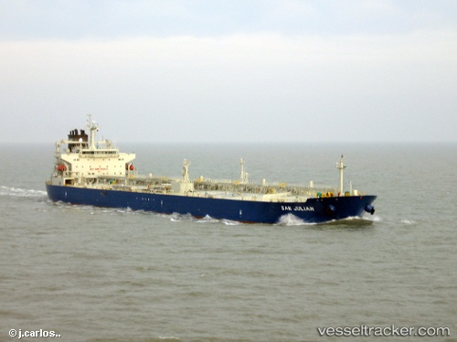
 SAN BARTH
Current Status
Where is the vessel?
SAN BARTH is currently in Near Bonny, based on AIS data received less than 1h ago.
Latest AIS update:
Current position: 4.46122° N, 7.16559° E (Near Bonny)
Average speed (last 7 days): Loading…
Average speed (last 30 days): Loading…
Vessel profile: SAN BARTH is a Tanker with dimensions m x m.
This page combines live AIS, route history, probable destination signals, nearby traffic, and port activity for practical vessel monitoring.
The current position of vessel SAN BARTH is 4.46122 lat / 7.16559 lng. Updated: 2026-05-17 23:22:35 UTCNearest reference points:
- Near Bonny
- Near Onne
- Near Ima
Currently sailing under the flag of Marshall Islands ![]()
Details:
Live Vessel SAN BARTH Analytics (details, animations, etc.)
Recent AIS points (UTC):
2026-05-17 20:07:35 UTC · 4.46101, 7.16548 · SOG 0.4 kn · COG 26°2026-05-17 21:43:38 UTC · 4.46112, 7.16532 · SOG 0 kn · COG 32°
2026-05-17 22:43:36 UTC · 4.46113, 7.16535 · SOG 0 kn · COG 31°
2026-05-17 23:22:35 UTC · 4.46122, 7.16559 · SOG 0 kn · COG 25°