 vesseltracker.com
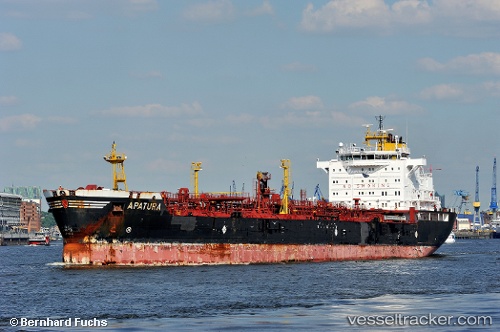
Alimas
Current StatusWhere is the vessel?
Alimas is currently in 374 nm SW of Veraval, based on AIS data received about 1h ago.
Latest AIS update:
Current position: 17.41167° N, 64.88500° E (374 nm SW of Veraval)
Average speed (last 7 days): Loading…
Average speed (last 30 days): Loading…
Vessel profile: Alimas is a Chemical Oil Products Tanker with dimensions 26m x 168m.
This page combines live AIS, route history, probable destination signals, nearby traffic, and port activity for practical vessel monitoring.
The current position of vessel Alimas is 17.41167 lat / 64.88500 lng. Updated: 2026-05-17 04:11:32 UTCNearest reference points:
- Open sea, approx. 402 nm off the nearest listed port
- Open sea, approx. 403 nm off the nearest listed port
- Open sea, approx. 401 nm off the nearest listed port
Details:
Live Vessel Alimas Analytics (details, animations, etc.)
Recent AIS points (UTC):
2026-05-17 01:17:00 UTC · 17.83167, 64.53833 · SOG 11 kn · COG -1°2026-05-17 02:20:10 UTC · 17.68167, 64.66333 · SOG 11 kn · COG -1°
2026-05-17 03:20:24 UTC · 17.53667, 64.78333 · SOG 11 kn · COG -1°
2026-05-17 04:11:32 UTC · 17.41167, 64.88500 · SOG 11 kn · COG -1°