 vesseltracker.com
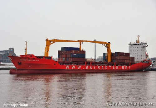
Vessel Burak Bayraktar IMO: 9260536, MMSI: 271000691 Container Ship
UTC, 40.90096, 27.47000, course: 22, speed: 0
UTC, 40.90095, 27.47000, course: 21, speed: 0
2026-01-25 16:05:21 UTC, 40.90094, 27.46999, course: 21, speed: 0
Live AIS position:
UTC. Near BARBAROS),
updated 2026-01-25 16:05:21 UTC.
Find the position of the vessel Burak Bayraktar on the map. The latter are known coordinates and path.
marine traffic ship tracker show on live map
The current position of vessel Burak Bayraktar is 40.90094 lat / 27.46999 lng. Updated: 2026-01-25 16:05:21 UTCCurrently sailing under the flag of Turkey
Burak Bayraktar built in 2002 year
Deadweight:
11656 tDetails:
Last coordinates of the vessel:
UTC, 40.90095, 27.46999, course: 21, speed: 0UTC, 40.90096, 27.47000, course: 22, speed: 0
UTC, 40.90095, 27.47000, course: 21, speed: 0
2026-01-25 16:05:21 UTC, 40.90094, 27.46999, course: 21, speed: 0