 vesseltracker.com
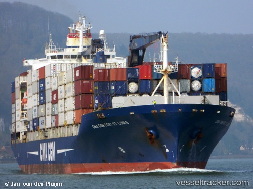
 CMA CGM FORT ST LOUIS
Current Status
Where is the vessel?
CMA CGM FORT ST LOUIS is currently in 18 nm N of Noord, based on AIS data received less than 1h ago.
Latest AIS update:
Current position: 12.85410° N, 69.93310° W (18 nm N of Noord)
Average speed (last 7 days): Loading…
Average speed (last 30 days): Loading…
Vessel profile: CMA CGM FORT ST LOUIS is a Container Ship with dimensions 198m x 30m.
This page combines live AIS, route history, probable destination signals, nearby traffic, and port activity for practical vessel monitoring.
The current position of vessel CMA CGM FORT ST LOUIS is 12.85410 lat / -69.93310 lng. Updated: 2026-05-18 05:44:31 UTCNearest reference points:
- 24 nm NW of Palm Beach
- Near Bullenbaai
- Near Las Piedras
Currently sailing under the flag of Cyprus ![]()
CMA CGM FORT ST LOUIS built in 2003 year
Deadweight:
30804 tDetails:
Live Vessel CMA CGM FORT ST LOUIS Analytics (details, animations, etc.)
Recent AIS points (UTC):
2026-05-18 02:20:24 UTC · 12.79554, -70.79717 · SOG 15 kn · COG 86°2026-05-18 04:23:49 UTC · 12.86036, -70.27704 · SOG 15.1 kn · COG 88°
2026-05-18 04:43:01 UTC · 12.86810, -70.19442 · SOG 15.1 kn · COG 88°
2026-05-18 05:44:31 UTC · 12.85410, -69.93310 · SOG 15.2 kn · COG 104°