 vesseltracker.com
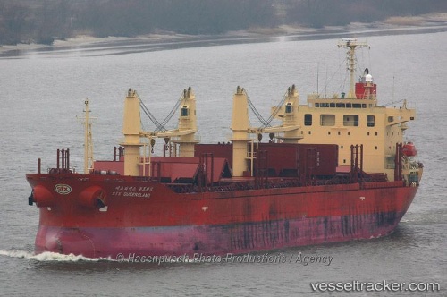
 LADY BABU
Current Status
Where is the vessel?
LADY BABU is currently in 362 nm E of Richards Bay, based on AIS data received less than 1h ago.
Latest AIS update:
Current position: 29.96560° S, 38.92653° E (362 nm E of Richards Bay)
Average speed (last 7 days): Loading…
Average speed (last 30 days): Loading…
Vessel profile: LADY BABU is a Bulk Carrier with dimensions m x m.
This page combines live AIS, route history, probable destination signals, nearby traffic, and port activity for practical vessel monitoring.
The current position of vessel LADY BABU is -29.96560 lat / 38.92653 lng. Updated: 2026-05-18 07:17:04 UTCNearest reference points:
- Open sea, approx. 401 nm off the nearest listed port
- Open sea, approx. 400 nm off the nearest listed port
- Open sea, approx. 402 nm off the nearest listed port
Currently sailing under the flag of Panama ![]()
Details:
Live Vessel LADY BABU Analytics (details, animations, etc.)
Recent AIS points (UTC):
2026-05-18 03:43:16 UTC · -30.26245, 38.19225 · SOG 12.1 kn · COG 68°2026-05-18 04:11:57 UTC · -30.22137, 38.29268 · SOG 12.1 kn · COG 68°
2026-05-18 05:52:55 UTC · -30.07928, 38.64290 · SOG 11.8 kn · COG 65°
2026-05-18 07:17:04 UTC · -29.96560, 38.92653 · SOG 11.2 kn · COG 65°