 vesseltracker.com
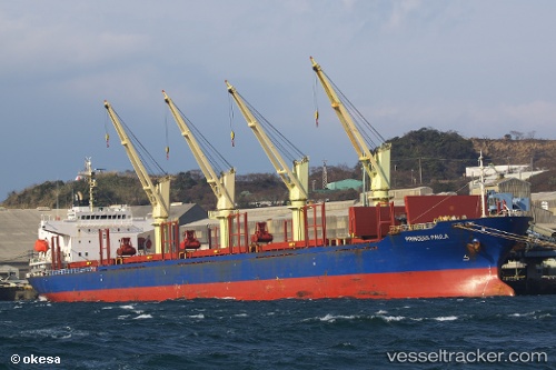
 BLUE CECIL
Current Status
Where is the vessel?
BLUE CECIL is currently in 29 nm E of TWEED HEADS, based on AIS data received less than 1h ago.
Latest AIS update:
Current position: 28.03908° S, 154.07588° E (29 nm E of TWEED HEADS)
Average speed (last 7 days): Loading…
Average speed (last 30 days): Loading…
Vessel profile: BLUE CECIL is a Bulk Carrier with dimensions 177m x 28m.
This page combines live AIS, route history, probable destination signals, nearby traffic, and port activity for practical vessel monitoring.
The current position of vessel BLUE CECIL is -28.03908 lat / 154.07588 lng. Updated: 2026-05-17 13:29:27 UTCNearest reference points:
- Near Gold Coast
- Near Labrador
- Near Biggera Waters
Currently sailing under the flag of Marshall Islands ![]()
BLUE CECIL built in 2004 year
Deadweight:
32564 tDetails:
Live Vessel BLUE CECIL Analytics (details, animations, etc.)
Recent AIS points (UTC):
2026-05-17 10:44:27 UTC · -27.45281, 154.05756 · SOG 12.6 kn · COG 176°2026-05-17 12:11:37 UTC · -27.75952, 154.07404 · SOG 12.6 kn · COG 169°
2026-05-17 13:07:38 UTC · -27.95766, 154.08215 · SOG 13 kn · COG 175°
2026-05-17 13:29:27 UTC · -28.03908, 154.07588 · SOG 13.5 kn · COG 190°