 vesseltracker.com
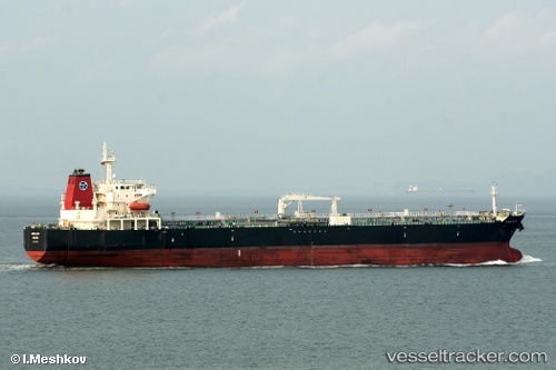
 ELIZABETH M
Current Status
Where is the vessel?
ELIZABETH M is currently in 12 nm N of Oye-Plage, based on AIS data received less than 1h ago.
Latest AIS update:
Current position: 51.17073° N, 1.93632° E (12 nm N of Oye-Plage)
Average speed (last 7 days): Loading…
Average speed (last 30 days): Loading…
Vessel profile: ELIZABETH M is a Crude Oil Tanker with dimensions 32m x 189m.
This page combines live AIS, route history, probable destination signals, nearby traffic, and port activity for practical vessel monitoring.
The current position of vessel ELIZABETH M is 51.17073 lat / 1.93632 lng. Updated: 2026-05-18 03:40:01 UTCNearest reference points:
- 15 nm E of RAMSGATE
- 14 nm SE of RAMSGATE
- Near Calais
Currently sailing under the flag of Marshall Islands ![]()
ELIZABETH M built in 2007 year
Deadweight:
50359 tDetails:
Live Vessel ELIZABETH M Analytics (details, animations, etc.)
Recent AIS points (UTC):
2026-05-17 23:24:05 UTC · 50.50243, 0.95464 · SOG 12.6 kn · COG 71°2026-05-18 01:48:05 UTC · 50.89724, 1.43788 · SOG 13.9 kn · COG 6°
2026-05-18 02:13:15 UTC · 50.96999, 1.53759 · SOG 14.2 kn · COG 49°
2026-05-18 03:40:01 UTC · 51.17073, 1.93632 · SOG 12.7 kn · COG 64°