 vesseltracker.com
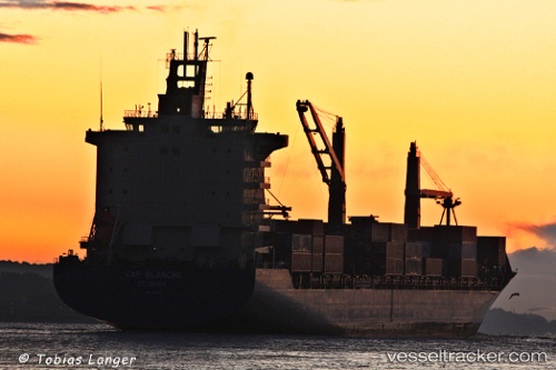
As Carlotta
Current StatusWhere is the vessel?
As Carlotta is currently in 32 nm E of HITAKATSU, based on AIS data received less than 1h ago.
Latest AIS update:
Current position: 34.81744° N, 130.10143° E (32 nm E of HITAKATSU)
Average speed (last 7 days): Loading…
Average speed (last 30 days): Loading…
Vessel profile: As Carlotta is a Container Ship with dimensions 28m x 222m.
This page combines live AIS, route history, probable destination signals, nearby traffic, and port activity for practical vessel monitoring.
The current position of vessel As Carlotta is 34.81744 lat / 130.10143 lng. Updated: 2026-05-17 21:32:03 UTCNearest reference points:
- 30 nm NW of Hibiki-Nada
- 29 nm NW of Hibiki-Nada
- 27 nm SE of ONSAN
Details:
Live Vessel As Carlotta Analytics (details, animations, etc.)
Recent AIS points (UTC):
2026-05-17 18:02:03 UTC · 34.79968, 130.10069 · SOG 0.4 kn · COG 18°2026-05-17 20:03:13 UTC · 34.81277, 130.10315 · SOG 0.4 kn · COG 293°
2026-05-17 20:17:04 UTC · 34.81360, 130.10222 · SOG 0.2 kn · COG 281°
2026-05-17 21:32:03 UTC · 34.81744, 130.10143 · SOG 0.3 kn · COG 237°