 vesseltracker.com
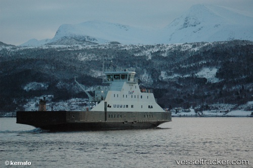
 Julsund
Current Status
Where is the vessel?
Julsund is currently in Near Sunde, based on AIS data received less than 1h ago.
Latest AIS update:
Current position: 59.86724° N, 5.56379° E (Near Sunde)
Average speed (last 7 days): Loading…
Average speed (last 30 days): Loading…
Vessel profile: Julsund is a Passenger Ro Ro Cargo Ship with dimensions 84m x 17m.
This page combines live AIS, route history, probable destination signals, nearby traffic, and port activity for practical vessel monitoring.
The current position of vessel Julsund is 59.86724 lat / 5.56379 lng. Updated: 2026-05-17 22:41:48 UTCNearest reference points:
- Near Halsnøy
- Near Valevåg
- Near SANDVIKVAAG
Currently sailing under the flag of Norway ![]()
Julsund built in 2004 year
Details:
Live Vessel Julsund Analytics (details, animations, etc.)
Recent AIS points (UTC):
2026-05-17 19:31:59 UTC · 59.88656, 5.52115 · SOG 0 kn · COG 163°2026-05-17 20:08:52 UTC · 59.88932, 5.55743 · SOG 0 kn · COG 39°
2026-05-17 21:41:47 UTC · 59.86726, 5.56374 · SOG 0 kn · COG 195°
2026-05-17 22:41:48 UTC · 59.86724, 5.56379 · SOG 0 kn · COG 192°