 vesseltracker.com
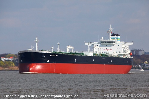
 Penelop
Current Status
Where is the vessel?
Penelop is currently in 57 nm W of Hougharry and Loch Eport, based on AIS data received about 1h ago.
Latest AIS update:
Current position: 57.36167° N, 9.27167° W (57 nm W of Hougharry and Loch Eport)
Average speed (last 7 days): Loading…
Average speed (last 30 days): Loading…
Vessel profile: Penelop is a Crude Oil Tanker with dimensions 255m x 44m.
This page combines live AIS, route history, probable destination signals, nearby traffic, and port activity for practical vessel monitoring.
The current position of vessel Penelop is 57.36167 lat / -9.27167 lng. Updated: 2026-05-17 10:28:46 UTCNearest reference points:
- Near North Harris
Currently sailing under the flag of Bahamas ![]()
Penelop built in 2006 year
Deadweight:
115091 tDetails:
Live Vessel Penelop Analytics (details, animations, etc.)
Recent AIS points (UTC):
2026-05-17 07:28:42 UTC · 57.82500, -9.03833 · SOG 9 kn · COG -1°2026-05-17 08:04:44 UTC · 57.73333, -9.08500 · SOG 9 kn · COG -1°
2026-05-17 10:19:48 UTC · 57.38500, -9.25833 · SOG 9 kn · COG -1°
2026-05-17 10:28:46 UTC · 57.36167, -9.27167 · SOG 9 kn · COG -1°