 vesseltracker.com
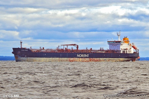
 OCEAN EMBRACE
Current Status
Where is the vessel?
OCEAN EMBRACE is currently in Near YALOVA, based on AIS data received less than 1h ago.
Latest AIS update:
Current position: 40.71760° N, 29.47353° E (Near YALOVA)
Average speed (last 7 days): Loading…
Average speed (last 30 days): Loading…
Vessel profile: OCEAN EMBRACE is a Oil/Chemical Tanker with dimensions m x m.
This page combines live AIS, route history, probable destination signals, nearby traffic, and port activity for practical vessel monitoring.
The current position of vessel OCEAN EMBRACE is 40.71760 lat / 29.47353 lng. Updated: 2026-05-17 12:10:40 UTCNearest reference points:
- Near YALOVA
- Near Yilport
- Near Diliskelesi
Currently sailing under the flag of Sierra Leone ![]()
Details:
Live Vessel OCEAN EMBRACE Analytics (details, animations, etc.)
Recent AIS points (UTC):
2026-05-17 07:43:38 UTC · 40.71768, 29.47355 · SOG 0 kn · COG 305°2026-05-17 09:25:34 UTC · 40.71770, 29.47351 · SOG 0 kn · COG 305°
2026-05-17 10:13:40 UTC · 40.71768, 29.47353 · SOG 0 kn · COG 305°
2026-05-17 12:10:40 UTC · 40.71760, 29.47353 · SOG 0 kn · COG 306°