 vesseltracker.com
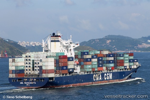
Anl Wangaratta
Current StatusWhere is the vessel?
Anl Wangaratta is currently in 177 nm NE of Cap Malheureux, based on AIS data received less than 1h ago.
Latest AIS update:
Current position: 18.16320° S, 60.06460° E (177 nm NE of Cap Malheureux)
Average speed (last 7 days): Loading…
Average speed (last 30 days): Loading…
Vessel profile: Anl Wangaratta is a Container Ship with dimensions 32m x 260m.
This page combines live AIS, route history, probable destination signals, nearby traffic, and port activity for practical vessel monitoring.
The current position of vessel Anl Wangaratta is -18.1632 lat / 60.0646 lng. Updated: 2026-05-17 22:16:57 UTCNearest reference points:
- 159 nm W of Rodrigues
- 106 nm NW of Port Mathurin
- 219 nm NW of Port Mathurin
Details:
Live Vessel Anl Wangaratta Analytics (details, animations, etc.)
Recent AIS points (UTC):
2026-05-17 19:20:27 UTC · -17.85210, 60.60440 · SOG 12.2 kn · COG 235°2026-05-17 19:35:28 UTC · -17.87910, 60.55920 · SOG 11.9 kn · COG 239°
2026-05-17 21:25:36 UTC · -18.06900, 60.21880 · SOG 12.5 kn · COG 241°
2026-05-17 22:16:57 UTC · -18.16320, 60.06460 · SOG 12 kn · COG 237°