 vesseltracker.com
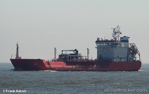
 Luke
Luke
Current Status
Where is the vessel?
Luke is currently in Near KARINGON, based on AIS data received less than 1h ago.
Latest AIS update:
Current position: 58.20520° N, 11.25087° E (Near KARINGON)
Average speed (last 7 days): Loading…
Average speed (last 30 days): Loading…
Vessel profile: Luke is a Lpg Tanker with dimensions 84m x 15m.
This page combines live AIS, route history, probable destination signals, nearby traffic, and port activity for practical vessel monitoring.
The current position of vessel Luke is 58.20520 lat / 11.25087 lng. Updated: 2026-05-18 07:49:27 UTCNearest reference points:
- Near SMOGEN
- Near Brofjorden
- Near Ellös
Currently sailing under the flag of Portugal ![]()
Luke built in 2006 year
Deadweight:
3811 tDetails:
Live Vessel Luke Analytics (details, animations, etc.)
Recent AIS points (UTC):
2026-05-18 04:46:28 UTC · 58.20515, 11.25098 · SOG 0 kn · COG 118°2026-05-18 05:31:27 UTC · 58.20510, 11.25093 · SOG 0 kn · COG 120°
2026-05-18 07:37:26 UTC · 58.20523, 11.25087 · SOG 0 kn · COG 128°
2026-05-18 07:49:27 UTC · 58.20520, 11.25087 · SOG 0 kn · COG 128°