 vesseltracker.com
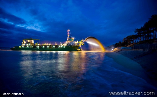
Marieke
Current StatusWhere is the vessel?
Marieke is currently in Near Tso-Ying, based on AIS data received less than 1h ago.
Latest AIS update:
Current position: 22.71042° N, 120.25043° E (Near Tso-Ying)
Average speed (last 7 days): Loading…
Average speed (last 30 days): Loading…
Vessel profile: Marieke is a Hopper Dredger with dimensions 22m x 98m.
This page combines live AIS, route history, probable destination signals, nearby traffic, and port activity for practical vessel monitoring.
The current position of vessel Marieke is 22.71042 lat / 120.25043 lng. Updated: 2026-05-17 16:26:37 UTCNearest reference points:
- Near Tso-Ying
- Near YUNG AN
- Near Kao-Hsiung Kang
Details:
Live Vessel Marieke Analytics (details, animations, etc.)
Recent AIS points (UTC):
2026-05-17 13:44:30 UTC · 22.70983, 120.25093 · SOG 1.2 kn · COG 308°2026-05-17 13:53:31 UTC · 22.70839, 120.25034 · SOG 0.7 kn · COG 145°
2026-05-17 15:50:38 UTC · 22.71062, 120.25018 · SOG 1.3 kn · COG 329°
2026-05-17 16:26:37 UTC · 22.71042, 120.25043 · SOG 1.4 kn · COG 339°