 vesseltracker.com
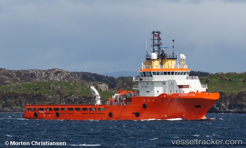
 OCEANICASUB XVII
Current Status
Where is the vessel?
OCEANICASUB XVII is currently in 62 nm S of Forno Pt/Arraial do Cabo, based on AIS data received about 15h ago.
Latest AIS update:
Current position: 23.96870° S, 42.32992° W (62 nm S of Forno Pt/Arraial do Cabo)
Average speed (last 7 days): Loading…
Average speed (last 30 days): Loading…
Vessel profile: OCEANICASUB XVII is a Anchor Handling Vessel with dimensions m x m.
This page combines live AIS, route history, probable destination signals, nearby traffic, and port activity for practical vessel monitoring.
The current position of vessel OCEANICASUB XVII is -23.96870 lat / -42.32992 lng. Updated: 2026-05-17 17:31:05 UTCNearest reference points:
- 69 nm NE of Cidade de Angra dos Reis FPSO
- Near Santos Dumont Apt/Rio de Janeiro
- 27 nm SW of Santos Dumont Apt/Rio de Janeiro
Currently sailing under the flag of United Kingdom ![]()
Details:
Live Vessel OCEANICASUB XVII Analytics (details, animations, etc.)
Recent AIS points (UTC):
2026-05-17 13:52:53 UTC · -23.96860, -42.33257 · SOG 0.6 kn · COG 215°2026-05-17 15:59:59 UTC · -23.96833, -42.32833 · SOG 0 kn · COG -1°
2026-05-17 17:05:58 UTC · -23.96833, -42.32833 · SOG 0 kn · COG -1°
2026-05-17 17:31:05 UTC · -23.96870, -42.32992 · SOG 0.1 kn · COG 317°