 vesseltracker.com
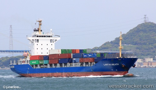
 Lantau Beach
Current Status
Where is the vessel?
Lantau Beach is currently in 43 nm W of Ikitsuki, based on AIS data received about 1h ago.
Latest AIS update:
Current position: 33.18885° N, 128.59857° E (43 nm W of Ikitsuki)
Average speed (last 7 days): Loading…
Average speed (last 30 days): Loading…
Vessel profile: Lantau Beach is a Container Ship with dimensions 143m x 23m.
This page combines live AIS, route history, probable destination signals, nearby traffic, and port activity for practical vessel monitoring.
The current position of vessel Lantau Beach is 33.18885 lat / 128.59857 lng. Updated: 2026-05-17 21:31:53 UTCNearest reference points:
- 33 nm W of IZUHARA
- 25 nm S of Kukdo
- Near MATSUSHIMA
Currently sailing under the flag of Antigua Barbuda ![]()
Lantau Beach built in 2007 year
Deadweight:
12829 tDetails:
Live Vessel Lantau Beach Analytics (details, animations, etc.)
Recent AIS points (UTC):
2026-05-17 18:01:54 UTC · 32.81002, 127.60252 · SOG 15.8 kn · COG 66°2026-05-17 19:54:35 UTC · 33.00235, 128.13699 · SOG 15.3 kn · COG 63°
2026-05-17 20:17:00 UTC · 33.04278, 128.24229 · SOG 15.7 kn · COG 63°
2026-05-17 21:31:53 UTC · 33.18885, 128.59857 · SOG 15.8 kn · COG 66°