 vesseltracker.com
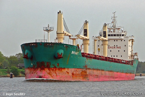
 Brant
Brant
Current Status
Where is the vessel?
Brant is currently in 44 nm SE of Sao Sebastiao, based on AIS data received less than 1h ago.
Latest AIS update:
Current position: 24.17194° S, 44.67594° W (44 nm SE of Sao Sebastiao)
Average speed (last 7 days): Loading…
Average speed (last 30 days): Loading…
Vessel profile: Brant is a Bulk Carrier with dimensions 185m x 24m.
This page combines live AIS, route history, probable destination signals, nearby traffic, and port activity for practical vessel monitoring.
The current position of vessel Brant is -24.17194 lat / -44.67594 lng. Updated: 2026-05-17 07:57:10 UTCNearest reference points:
- 61 nm S of TEBIG
- Near Barrosso Terminal
- 56 nm S of Sao Sebastiao
Currently sailing under the flag of Cyprus ![]()
Brant built in 2008 year
Deadweight:
30776 tDetails:
Live Vessel Brant Analytics (details, animations, etc.)
Recent AIS points (UTC):
2026-05-17 04:17:00 UTC · -23.94339, -43.94767 · SOG 11.9 kn · COG 246°2026-05-17 06:29:28 UTC · -24.07577, -44.39371 · SOG 11.1 kn · COG 256°
2026-05-17 07:48:56 UTC · -24.16833, -44.64667 · SOG 11 kn · COG -1°
2026-05-17 07:57:10 UTC · -24.17194, -44.67594 · SOG 11.3 kn · COG 262°