 vesseltracker.com
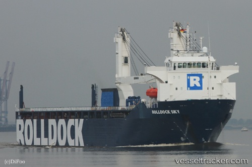
 Rolldock Sky
Current Status
Where is the vessel?
Rolldock Sky is currently in 116 nm W of Eureka Springs, based on AIS data received less than 1h ago.
Latest AIS update:
Current position: 36.92833° N, 42.05667° W (116 nm W of Eureka Springs)
Average speed (last 7 days): Loading…
Average speed (last 30 days): Loading…
Vessel profile: Rolldock Sky is a Heavy Load Carrier with dimensions 141m x 24m.
This page combines live AIS, route history, probable destination signals, nearby traffic, and port activity for practical vessel monitoring.
The current position of vessel Rolldock Sky is 36.92833 lat / -42.05667 lng. Updated: 2026-05-17 03:28:21 UTCNearest reference points:
- 47 nm W of Eureka Springs
- 97 nm SE of Chapineria
Currently sailing under the flag of Netherlands ![]()
Details:
Live Vessel Rolldock Sky Analytics (details, animations, etc.)
Recent AIS points (UTC):
2026-05-16 23:56:33 UTC · 37.28986, -41.29404 · SOG 12.6 kn · COG 237°2026-05-17 01:34:02 UTC · 37.12500, -41.65500 · SOG 12 kn · COG -1°
2026-05-17 01:40:04 UTC · 37.11500, -41.67667 · SOG 12 kn · COG -1°
2026-05-17 03:28:21 UTC · 36.92833, -42.05667 · SOG 12 kn · COG -1°