 vesseltracker.com
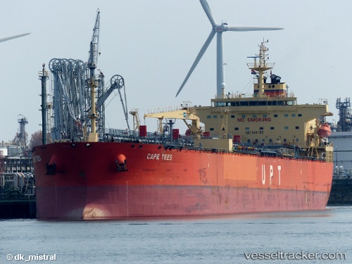
Cape Tees
Current StatusWhere is the vessel?
Cape Tees is currently in Near Petrozuata, based on AIS data received less than 1h ago.
Latest AIS update:
Current position: 10.13586° N, 64.82862° W (Near Petrozuata)
Average speed (last 7 days): Loading…
Average speed (last 30 days): Loading…
Vessel profile: Cape Tees is a Crude Oil Tanker with dimensions 32m x 228m.
This page combines live AIS, route history, probable destination signals, nearby traffic, and port activity for practical vessel monitoring.
The current position of vessel Cape Tees is 10.13586 lat / -64.82862 lng. Updated: 2026-05-17 19:53:46 UTCNearest reference points:
- Near Puerto Sucre
- 15 nm SW of Punta de Piedras
Details:
Live Vessel Cape Tees Analytics (details, animations, etc.)
Recent AIS points (UTC):
2026-05-17 16:12:34 UTC · 10.13589, -64.82862 · SOG 0 kn · COG 203°2026-05-17 17:27:44 UTC · 10.13589, -64.82860 · SOG 0 kn · COG 203°
2026-05-17 19:02:45 UTC · 10.13588, -64.82861 · SOG 0 kn · COG 203°
2026-05-17 19:53:46 UTC · 10.13586, -64.82862 · SOG 0 kn · COG 203°