 vesseltracker.com
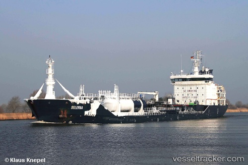
 Selenka
Current Status
Where is the vessel?
Selenka is currently in 32 nm E of Fisher Island, Miami, based on AIS data received about 1d ago.
Latest AIS update:
Current position: 25.56271° N, 79.57716° W (32 nm E of Fisher Island, Miami)
Average speed (last 7 days): Loading…
Average speed (last 30 days): Loading…
Vessel profile: Selenka is a Chemical Oil Products Tanker with dimensions 132m x 19m.
This page combines live AIS, route history, probable destination signals, nearby traffic, and port activity for practical vessel monitoring.
The current position of vessel Selenka is 25.56271 lat / -79.57716 lng. Updated: 2026-05-16 16:12:43 UTCNearest reference points:
- 44 nm E of Surfside
- Near Fisher Island, Miami
- 11 nm SE of Cutler Bay
Currently sailing under the flag of Malta ![]()
Selenka built in 2009 year
Deadweight:
10745 tDetails:
Live Vessel Selenka Analytics (details, animations, etc.)
Recent AIS points (UTC):
2026-05-16 16:12:43 UTC · 25.56271, -79.57716 · SOG 10.2 kn · COG 188°2026-05-16 16:12:43 UTC · 25.56271, -79.57716 · SOG 10.2 kn · COG 188°
2026-05-16 16:12:43 UTC · 25.56271, -79.57716 · SOG 10.2 kn · COG 188°
2026-05-16 16:12:43 UTC · 25.56271, -79.57716 · SOG 10.2 kn · COG 188°