 vesseltracker.com
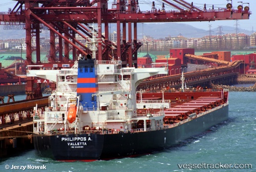
 Philippos A.
Current Status
Where is the vessel?
Philippos A. is currently in 36 nm E of Pagerungan, based on AIS data received about 1h ago.
Latest AIS update:
Current position: 6.88363° S, 116.52488° E (36 nm E of Pagerungan)
Average speed (last 7 days): Loading…
Average speed (last 30 days): Loading…
Vessel profile: Philippos A. is a Bulk Carrier with dimensions 291m x 45m.
This page combines live AIS, route history, probable destination signals, nearby traffic, and port activity for practical vessel monitoring.
The current position of vessel Philippos A. is -6.88363 lat / 116.52488 lng. Updated: 2026-05-18 03:39:21 UTCNearest reference points:
- 37 nm E of Pagerungan
- 74 nm NE of Pagerungan
- 34 nm N of Arjasa
Currently sailing under the flag of Malta ![]()
Details:
Live Vessel Philippos A. Analytics (details, animations, etc.)
Recent AIS points (UTC):
2026-05-18 00:14:29 UTC · -7.43346, 116.33310 · SOG 10.6 kn · COG 37°2026-05-18 00:14:29 UTC · -7.43346, 116.33310 · SOG 10.6 kn · COG 37°
2026-05-18 02:03:29 UTC · -7.14816, 116.44769 · SOG 10.1 kn · COG 21°
2026-05-18 03:39:21 UTC · -6.88363, 116.52488 · SOG 10.3 kn · COG 10°