 vesseltracker.com
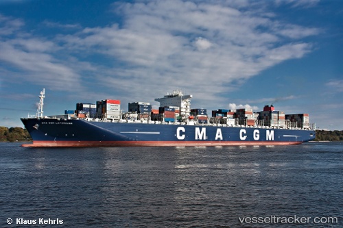
 CMA CGM LAPEROUSE
Current Status
Where is the vessel?
CMA CGM LAPEROUSE is currently in 259 nm W of Calang, based on AIS data received less than 1h ago.
Latest AIS update:
Current position: 3.31663° N, 91.46930° E (259 nm W of Calang)
Average speed (last 7 days): Loading…
Average speed (last 30 days): Loading…
Vessel profile: CMA CGM LAPEROUSE is a Container Ship with dimensions 365m x 52m.
This page combines live AIS, route history, probable destination signals, nearby traffic, and port activity for practical vessel monitoring.
The current position of vessel CMA CGM LAPEROUSE is 3.31663 lat / 91.4693 lng. Updated: 2026-05-17 22:08:57 UTCNearest reference points:
- Open sea, approx. 401 nm off the nearest listed port
Currently sailing under the flag of Malta ![]()
CMA CGM LAPEROUSE built in 2010 year
Deadweight:
165422 tDetails:
Live Vessel CMA CGM LAPEROUSE Analytics (details, animations, etc.)
Recent AIS points (UTC):
2026-05-17 17:32:53 UTC · 4.19833, 92.56670 · SOG 18 kn · COG -1°2026-05-17 19:24:15 UTC · 3.84500, 92.12500 · SOG 18 kn · COG -1°
2026-05-17 20:03:25 UTC · 3.71833, 91.96830 · SOG 18 kn · COG -1°
2026-05-17 22:08:57 UTC · 3.31663, 91.46930 · SOG 18.1 kn · COG 234°