 vesseltracker.com
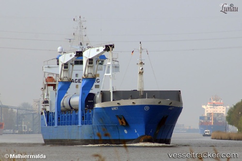
Anet
Current StatusWhere is the vessel?
Anet is currently in 12 nm SW of Oranjestad, based on AIS data received less than 1h ago.
Latest AIS update:
Current position: 17.33641° N, 63.14261° W (12 nm SW of Oranjestad)
Average speed (last 7 days): Loading…
Average speed (last 30 days): Loading…
Vessel profile: Anet is a Multi Purpose Carrier with dimensions 19m x 143m.
This page combines live AIS, route history, probable destination signals, nearby traffic, and port activity for practical vessel monitoring.
The current position of vessel Anet is 17.33641 lat / -63.14261 lng. Updated: 2026-05-17 20:01:24 UTCNearest reference points:
- Near GUSTAVIA
- Near ST MAARTEN
- Near Saint John's
Details:
Live Vessel Anet Analytics (details, animations, etc.)
Recent AIS points (UTC):
2026-05-17 16:23:27 UTC · 16.71294, -63.60783 · SOG 12.3 kn · COG 44°2026-05-17 17:25:53 UTC · 16.88167, -63.46667 · SOG 12 kn · COG -1°
2026-05-17 19:06:36 UTC · 17.15931, -63.23655 · SOG 12.7 kn · COG 29°
2026-05-17 20:01:24 UTC · 17.33641, -63.14261 · SOG 13.5 kn · COG 27°