 vesseltracker.com
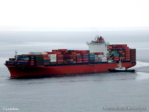
 Maliakos
Current Status
Where is the vessel?
Maliakos is currently in 151 nm E of Puerto Deseado, based on AIS data received about 1h ago.
Latest AIS update:
Current position: 46.79747° S, 62.50319° W (151 nm E of Puerto Deseado)
Average speed (last 7 days): Loading…
Average speed (last 30 days): Loading…
Vessel profile: Maliakos is a Container Ship with dimensions 262m x 32m.
This page combines live AIS, route history, probable destination signals, nearby traffic, and port activity for practical vessel monitoring.
The current position of vessel Maliakos is -46.79747 lat / -62.50319 lng. Updated: 2026-05-17 19:58:53 UTCCurrently sailing under the flag of Liberia ![]()
Maliakos built in 2012 year
Deadweight:
51310 tDetails:
Live Vessel Maliakos Analytics (details, animations, etc.)
Recent AIS points (UTC):
2026-05-17 16:24:14 UTC · -46.22957, -62.01072 · SOG 11.5 kn · COG 207°2026-05-17 17:29:24 UTC · -46.40689, -62.16414 · SOG 10.7 kn · COG 209°
2026-05-17 19:00:26 UTC · -46.64620, -62.37355 · SOG 11.1 kn · COG 207°
2026-05-17 19:58:53 UTC · -46.79747, -62.50319 · SOG 11.4 kn · COG 207°