 vesseltracker.com
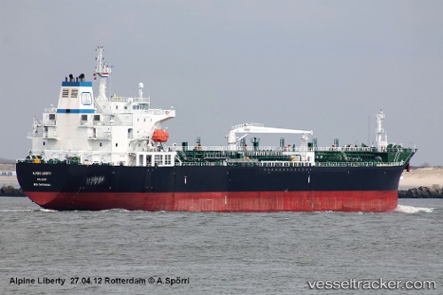
 Alpine Liberty
Current Status
Where is the vessel?
Alpine Liberty is currently in 105 nm NE of PANGKAL BALAM, based on AIS data received less than 1h ago.
Latest AIS update:
Current position: 0.54500° S, 106.95333° E (105 nm NE of PANGKAL BALAM)
Average speed (last 7 days): Loading…
Average speed (last 30 days): Loading…
Vessel profile: Alpine Liberty is a Chemical Oil Products Tanker with dimensions 182m x 32m.
This page combines live AIS, route history, probable destination signals, nearby traffic, and port activity for practical vessel monitoring.
The current position of vessel Alpine Liberty is -0.54500 lat / 106.95333 lng. Updated: 2026-05-18 00:01:27 UTCNearest reference points:
- 69 nm NE of Exspan
- 46 nm NW of Tanjung Pandan
- Near PANGKAL BALAM
Currently sailing under the flag of Marshall Is ![]()
Alpine Liberty built in 2010 year
Deadweight:
50223 tDetails:
Live Vessel Alpine Liberty Analytics (details, animations, etc.)
Recent AIS points (UTC):
2026-05-17 19:40:30 UTC · 0.12833, 106.42500 · SOG 11 kn · COG -1°2026-05-17 21:58:27 UTC · -0.25667, 106.66500 · SOG 11 kn · COG -1°
2026-05-17 22:13:28 UTC · -0.29167, 106.69833 · SOG 11 kn · COG -1°
2026-05-18 00:01:27 UTC · -0.54500, 106.95333 · SOG 12 kn · COG -1°