 vesseltracker.com
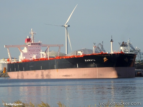
Samail
Current StatusWhere is the vessel?
Samail is currently in Open sea (no nearby ports in database), based on AIS data received less than 1h ago.
Latest AIS update:
Current position: 29.00416° S, 10.47730° W (Open sea (no nearby ports in database))
Average speed (last 7 days): Loading…
Average speed (last 30 days): Loading…
Vessel profile: Samail is a Crude Oil Tanker with dimensions 60m x 330m.
This page combines live AIS, route history, probable destination signals, nearby traffic, and port activity for practical vessel monitoring.
The current position of vessel Samail is -29.00416 lat / -10.47730 lng. Updated: 2026-05-17 01:25:38 UTCNearest reference points:
- Open sea (no nearby ports in database)
- Open sea, approx. 481 nm off the nearest listed port
- Open sea, approx. 484 nm off the nearest listed port
Details:
Live Vessel Samail Analytics (details, animations, etc.)
Recent AIS points (UTC):
2026-05-16 22:09:30 UTC · -29.24141, -9.61757 · SOG 14 kn · COG 290°2026-05-16 22:09:53 UTC · -29.24094, -9.61922 · SOG 14 kn · COG 289°
2026-05-16 23:27:37 UTC · -29.14680, -9.95733 · SOG 14.7 kn · COG 290°
2026-05-17 01:25:38 UTC · -29.00416, -10.47730 · SOG 14.2 kn · COG 287°