 vesseltracker.com
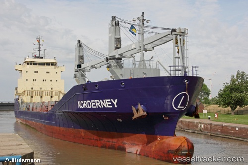
Vessel Norderney IMO: 9506124, MMSI: 305901000 Multi Purpose Carrier
UTC, -15.01853, 65.10110, course: 239, speed: 10
UTC, -15.18833, 64.81167, course: -1, speed: 9
2026-01-30 11:40:29 UTC, -15.36500, 64.50833, course: -1, speed: 10
Live AIS position:
UTC. 267 nm N of Port Mathurin),
updated 2026-01-30 11:40:29 UTC.
Find the position of the vessel Norderney on the map. The latter are known coordinates and path.
marine traffic ship tracker show on live map
The current position of vessel Norderney is -15.36500 lat / 64.50833 lng. Updated: 2026-01-30 11:40:29 UTCCurrently sailing under the flag of Antigua Barbuda
Norderney built in 2012 year
Deadweight:
5475 tDetails:
Last coordinates of the vessel:
UTC, -14.81667, 65.44500, course: -1, speed: 10UTC, -15.01853, 65.10110, course: 239, speed: 10
UTC, -15.18833, 64.81167, course: -1, speed: 9
2026-01-30 11:40:29 UTC, -15.36500, 64.50833, course: -1, speed: 10