 vesseltracker.com
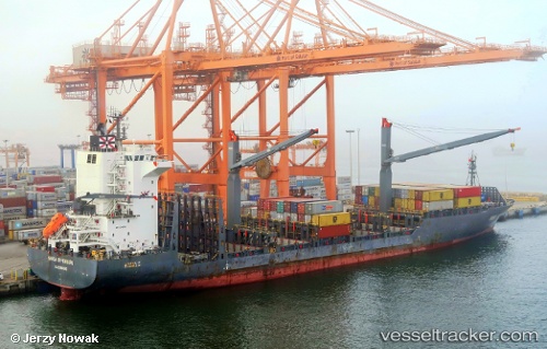
 ANL KOKODA
Current Status
Where is the vessel?
ANL KOKODA is currently in 58 nm NW of Amio, based on AIS data received less than 1h ago.
Latest AIS update:
Current position: 5.25985° S, 150.28975° E (58 nm NW of Amio)
Average speed (last 7 days): Loading…
Average speed (last 30 days): Loading…
Vessel profile: ANL KOKODA is a Container Ship with dimensions 27m x 175m.
This page combines live AIS, route history, probable destination signals, nearby traffic, and port activity for practical vessel monitoring.
The current position of vessel ANL KOKODA is -5.25985 lat / 150.28975 lng. Updated: 2026-05-17 21:46:52 UTCNearest reference points:
- Near Rabaul
- 42 nm E of Tami Island
- 15 nm SW of Lambom Island
Currently sailing under the flag of Malta ![]()
ANL KOKODA built in 2011 year
Deadweight:
23314 tDetails:
Live Vessel ANL KOKODA Analytics (details, animations, etc.)
Recent AIS points (UTC):
2026-05-17 17:44:07 UTC · -4.98570, 149.65462 · SOG 13.6 kn · COG 79°2026-05-17 19:33:03 UTC · -4.92167, 150.05167 · SOG 13 kn · COG -1°
2026-05-17 20:21:08 UTC · -4.97833, 150.21500 · SOG 14 kn · COG -1°
2026-05-17 21:46:52 UTC · -5.25985, 150.28975 · SOG 12.4 kn · COG 193°