 vesseltracker.com
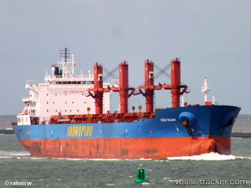
Sveti Dujam
Current StatusWhere is the vessel?
Sveti Dujam is currently in Near Mobile, based on AIS data received about 1h ago.
Latest AIS update:
Current position: 30.70287° N, 88.03623° W (Near Mobile)
Average speed (last 7 days): Loading…
Average speed (last 30 days): Loading…
Vessel profile: Sveti Dujam is a Bulk Carrier with dimensions 32m x 190m.
This page combines live AIS, route history, probable destination signals, nearby traffic, and port activity for practical vessel monitoring.
The current position of vessel Sveti Dujam is 30.70287 lat / -88.03623 lng. Updated: 2026-05-17 22:11:36 UTCNearest reference points:
- Near Mobile
- Near Pinto Island
- Near Chickasaw
Details:
Live Vessel Sveti Dujam Analytics (details, animations, etc.)
Recent AIS points (UTC):
2026-05-17 19:47:36 UTC · 30.70287, -88.03624 · SOG 0 kn · COG 177°2026-05-17 20:11:37 UTC · 30.70288, -88.03626 · SOG 0 kn · COG 177°
2026-05-17 22:05:37 UTC · 30.70286, -88.03623 · SOG 0 kn · COG 177°
2026-05-17 22:11:36 UTC · 30.70287, -88.03623 · SOG 0 kn · COG 177°