 vesseltracker.com
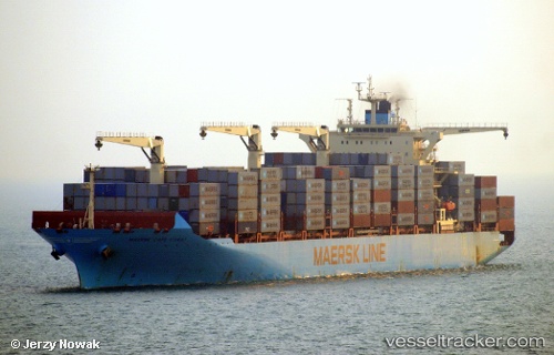
Maersk Cape Coast
Current StatusWhere is the vessel?
Maersk Cape Coast is currently in Open sea, approx. 422 nm off the nearest listed port, based on AIS data received less than 1h ago.
Latest AIS update:
Current position: 13.58756° S, 67.08559° E (Open sea, approx. 422 nm off the nearest listed port)
Average speed (last 7 days): Loading…
Average speed (last 30 days): Loading…
Vessel profile: Maersk Cape Coast is a Container Ship with dimensions 38m x 249m.
This page combines live AIS, route history, probable destination signals, nearby traffic, and port activity for practical vessel monitoring.
The current position of vessel Maersk Cape Coast is -13.58756 lat / 67.08559 lng. Updated: 2026-05-17 08:09:53 UTCNearest reference points:
- Open sea, approx. 422 nm off the nearest listed port
- Open sea, approx. 424 nm off the nearest listed port
- Open sea, approx. 421 nm off the nearest listed port
Details:
Live Vessel Maersk Cape Coast Analytics (details, animations, etc.)
Recent AIS points (UTC):
2026-05-17 04:22:24 UTC · -14.16634, 66.19537 · SOG 16.5 kn · COG 58°2026-05-17 06:05:37 UTC · -13.91399, 66.60980 · SOG 16.4 kn · COG 56°
2026-05-17 07:01:11 UTC · -13.76518, 66.82074 · SOG 16.4 kn · COG 55°
2026-05-17 08:09:53 UTC · -13.58756, 67.08559 · SOG 16.2 kn · COG 57°