 vesseltracker.com
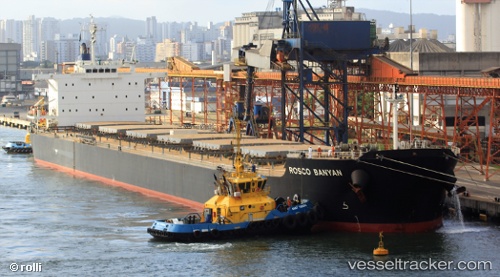
Rosco Banyan
Current StatusWhere is the vessel?
Rosco Banyan is currently in 27 nm SE of ZHOUSHAN, based on AIS data received less than 1h ago.
Latest AIS update:
Current position: 29.68506° N, 122.59420° E (27 nm SE of ZHOUSHAN)
Average speed (last 7 days): Loading…
Average speed (last 30 days): Loading…
Vessel profile: Rosco Banyan is a Bulk Carrier with dimensions 32m x 225m.
This page combines live AIS, route history, probable destination signals, nearby traffic, and port activity for practical vessel monitoring.
The current position of vessel Rosco Banyan is 29.68506 lat / 122.59420 lng. Updated: 2026-05-17 23:05:26 UTCNearest reference points:
- 24 nm SE of ZHOUSHAN
- 25 nm SE of ZHOUSHAN
- 20 nm SE of ZHOUSHAN
Details:
Live Vessel Rosco Banyan Analytics (details, animations, etc.)
Recent AIS points (UTC):
2026-05-17 20:04:17 UTC · 29.41571, 122.83988 · SOG 2.2 kn · COG 95°2026-05-17 20:18:06 UTC · 29.42270, 122.84781 · SOG 5.1 kn · COG 357°
2026-05-17 21:32:28 UTC · 29.59846, 122.82601 · SOG 10.7 kn · COG 13°
2026-05-17 23:05:26 UTC · 29.68506, 122.59420 · SOG 9.4 kn · COG 281°