 vesseltracker.com
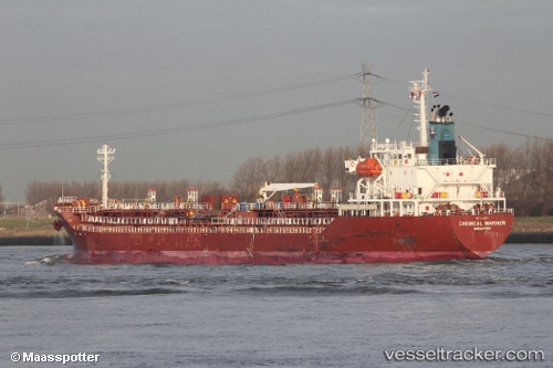
 CHEMICAL MARINER
Current Status
Where is the vessel?
CHEMICAL MARINER is currently in 47 nm N of Simancas, based on AIS data received about 1h ago.
Latest AIS update:
Current position: 42.36742° N, 4.80777° E (47 nm N of Simancas)
Average speed (last 7 days): Loading…
Average speed (last 30 days): Loading…
Vessel profile: CHEMICAL MARINER is a Oil/Chemical Tanker with dimensions m x m.
This page combines live AIS, route history, probable destination signals, nearby traffic, and port activity for practical vessel monitoring.
The current position of vessel CHEMICAL MARINER is 42.36742 lat / 4.80777 lng. Updated: 2026-05-17 15:07:09 UTCNearest reference points:
- 25 nm SW of Carro
- 23 nm SW of Toulon
- Near SAINT LOUIS DU RHONE
Currently sailing under the flag of Malta ![]()
Details:
Live Vessel CHEMICAL MARINER Analytics (details, animations, etc.)
Recent AIS points (UTC):
2026-05-17 13:28:29 UTC · 42.64877, 4.86833 · SOG 10.4 kn · COG 191°2026-05-17 13:46:50 UTC · 42.59720, 4.85598 · SOG 10.2 kn · COG 190°
2026-05-17 15:07:09 UTC · 42.36742, 4.80777 · SOG 10.5 kn · COG 196°
2026-05-17 15:07:09 UTC · 42.36742, 4.80777 · SOG 10.5 kn · COG 196°