 vesseltracker.com
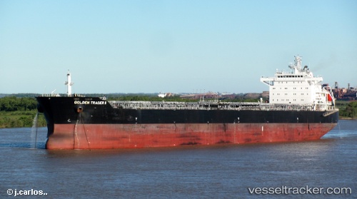
 Irene Madias
Current Status
Where is the vessel?
Irene Madias is currently in 60 nm NE of Oluvil, based on AIS data received about 1h ago.
Latest AIS update:
Current position: 8.16333° N, 82.34167° E (60 nm NE of Oluvil)
Average speed (last 7 days): Loading…
Average speed (last 30 days): Loading…
Vessel profile: Irene Madias is a Bulk Carrier with dimensions 229m x 32m.
This page combines live AIS, route history, probable destination signals, nearby traffic, and port activity for practical vessel monitoring.
The current position of vessel Irene Madias is 8.16333 lat / 82.34167 lng. Updated: 2026-05-17 05:17:24 UTCNearest reference points:
- 67 nm E of Oluvil
- 42 nm E of Konwelana
- 40 nm E of Konwelana
Currently sailing under the flag of Liberia ![]()
Irene Madias built in 2012 year
Deadweight:
79516 tDetails:
Live Vessel Irene Madias Analytics (details, animations, etc.)
Recent AIS points (UTC):
2026-05-17 02:17:23 UTC · 7.62333, 82.28500 · SOG 11 kn · COG -1°2026-05-17 03:23:21 UTC · 7.82500, 82.30833 · SOG 10 kn · COG -1°
2026-05-17 04:35:23 UTC · 8.04000, 82.32667 · SOG 10 kn · COG -1°
2026-05-17 05:17:24 UTC · 8.16333, 82.34167 · SOG 10 kn · COG -1°