 vesseltracker.com
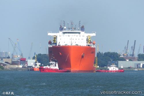
 Forte
Forte
Current Status
Where is the vessel?
Forte is currently in Near PASIR GUDANG, based on AIS data received less than 1h ago.
Latest AIS update:
Current position: 1.45738° N, 103.87367° E (Near PASIR GUDANG)
Average speed (last 7 days): Loading…
Average speed (last 30 days): Loading…
Vessel profile: Forte is a Heavy Load Carrier with dimensions 216m x 43m.
This page combines live AIS, route history, probable destination signals, nearby traffic, and port activity for practical vessel monitoring.
The current position of vessel Forte is 1.45738 lat / 103.87367 lng. Updated: 2026-05-18 00:07:39 UTCNearest reference points:
- Near PASIR GUDANG
- Near Johor
- Near SEMBAWANG
Currently sailing under the flag of Malta ![]()
Forte built in 2012 year
Deadweight:
48164 tDetails:
Live Vessel Forte Analytics (details, animations, etc.)
Recent AIS points (UTC):
2026-05-17 19:44:43 UTC · 1.45667, 103.87333 · SOG 0 kn · COG -1°2026-05-17 22:01:42 UTC · 1.45735, 103.87368 · SOG 0 kn · COG 143°
2026-05-17 22:13:43 UTC · 1.45736, 103.87368 · SOG 0 kn · COG 143°
2026-05-18 00:07:39 UTC · 1.45738, 103.87367 · SOG 0 kn · COG 143°