 vesseltracker.com
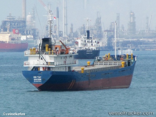
Hotay
Current StatusWhere is the vessel?
Hotay is currently in Near Tanjung Setapa, based on AIS data received less than 1h ago.
Latest AIS update:
Current position: 1.33939° N, 104.09925° E (Near Tanjung Setapa)
Average speed (last 7 days): Loading…
Average speed (last 30 days): Loading…
Vessel profile: Hotay is a Bulk Carrier with dimensions 12m x 76m.
This page combines live AIS, route history, probable destination signals, nearby traffic, and port activity for practical vessel monitoring.
The current position of vessel Hotay is 1.33939 lat / 104.09925 lng. Updated: 2026-05-17 16:24:09 UTCNearest reference points:
- Near Tanjung Setapa
- Near TANAH MERAH
- Near PENGERANG
Details:
Live Vessel Hotay Analytics (details, animations, etc.)
Recent AIS points (UTC):
2026-05-17 14:18:10 UTC · 1.34010, 104.09825 · SOG 0 kn · COG 145°2026-05-17 16:03:07 UTC · 1.33970, 104.09918 · SOG 0 kn · COG 258°
2026-05-17 16:03:07 UTC · 1.33970, 104.09918 · SOG 0 kn · COG 258°
2026-05-17 16:24:09 UTC · 1.33939, 104.09925 · SOG 0 kn · COG 282°